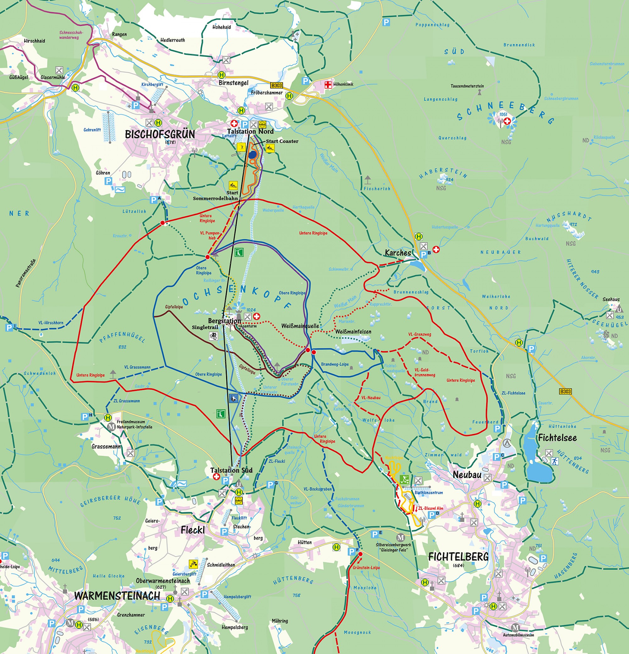
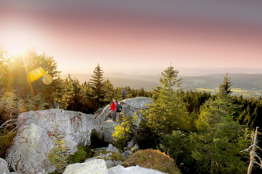
Hiking & nordic walking
Zone out, relax and enjoy – with a huge variety of hiking paths around the Ochsenkopf Mountain your stay here will feel like wellness for your soul.
Zone out, relax and enjoy – with a huge variety of hiking paths around the Ochsenkopf Mountain your stay here will feel like wellness for your soul.
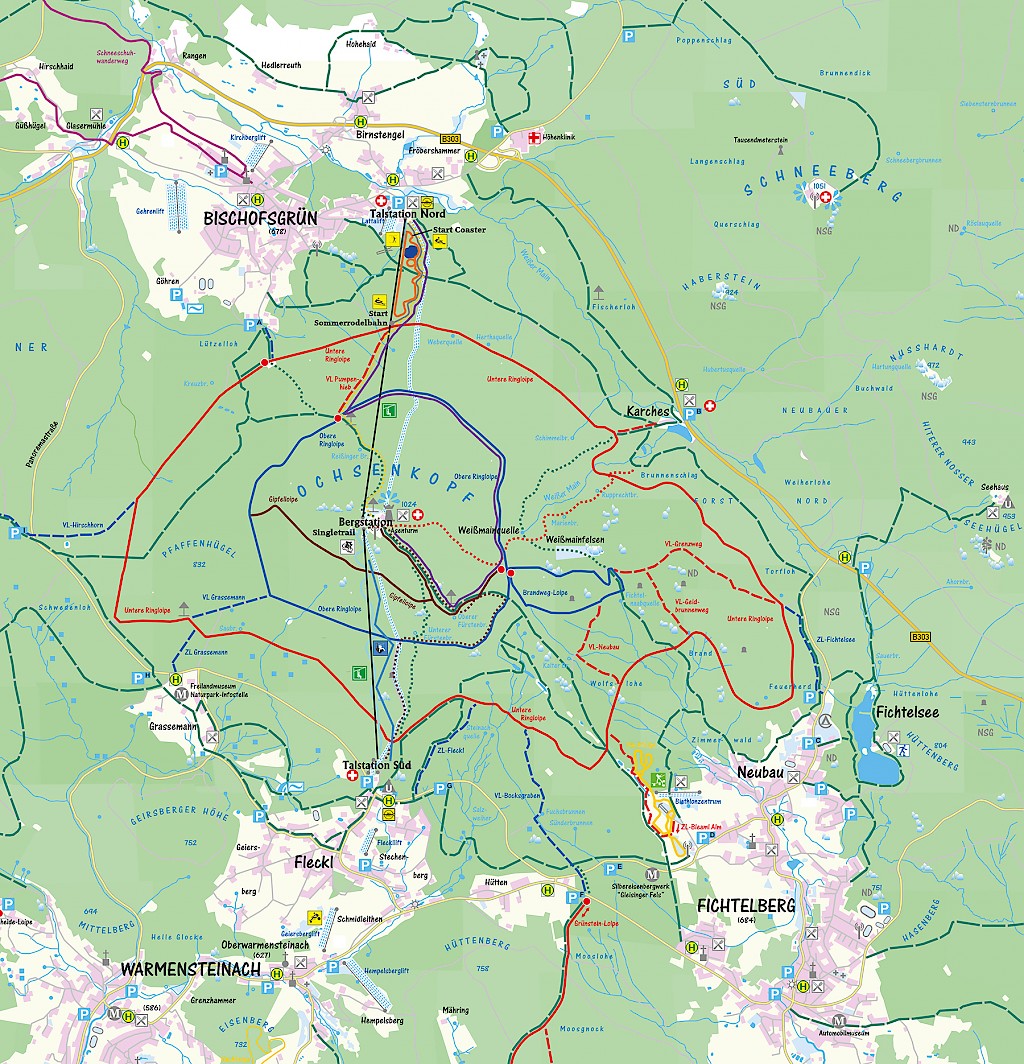
Zone out, relax and enjoy - The massive stone formations will strike you just as the silent small-streams that originate at the Ochsenkopf Mountain. Many trails lead to various sites around the mountain. One of which is the “Goetheweg” with a length of only 5 km. The Ochsenkopf is part of one of the longest hiking paths in the area, the Franconian hiking path, which has a total length of 420 km.
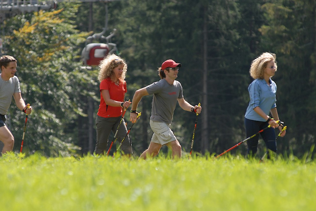
If you prefer a whole-body workout, why not go Nordic?! Not only is this sport super healthy for your heart, it also relieves your joints and is a many-sided way to enjoy nature and strengthen your body. The “Nordic Park Fichtelgebirge” is a road network of 70 routes with a difference in altitude of 12000 m in total. It is designed to please everyone who enjoys Nordic walking. Of course the necessary equipment can be borrowed at a near-by shop.
Foot- and cyclepath, forest path gravelled, length 14,5 km, difference in altitude 250m
Foot- and cyclepath, forest path gravelled, length 6,1 km, difference in altitude 107m
Foot- and cyclepath, forest path gravelled, length 3,6 km, difference in altitude 101m
comfortable trail, forest path, length 3 km, difference in altitude 250 m, hiking time aproxx. 45 min
Gravel, roots, rocks, length 2,2 km, difference in altitude 250 m, hiking time aproxx. 30 - 40 min
Comfortable hiking trail crossing the summer toboggan run, forest path gravelled, length 5,5 km, difference in altitude 350 m, hiking time aproxx. 90 min
Forest path, hiking trail, gravel, roots, rocks, length (Peak to start summer toboggan run) 1,9 km, difference in altitude 200 m, hiking time aproxx. 30 min. Length (Start summer toboggan run to valley Station North) 1,0 km, difference in altitude 150 m, hiking time aproxx. 15 min.
Forest path, hiking trail, length (Peak to "Weißmainquelle") 1,7 km, difference in altitude 120m, hiking time aproxx. 25 min. Length "Weißmainquelle" to "Karches" 1,5 km, difference in altitude 160m, hiking time aproxx. 25 min.
Personal information can be obtained during our operating hours in the summer season under the telephone number +49 (0) 9276 / 604 (During the winter season daily report on winter sports).
The Team of Ochsenkopf wishes you a nice day.
Impressum | Disclaimer | Datenschutz
Talstation Süd
Fleckl 40
95485 Warmensteinach
Talstation Nord
Fröbershammer 27
95493 Bischofsgrün